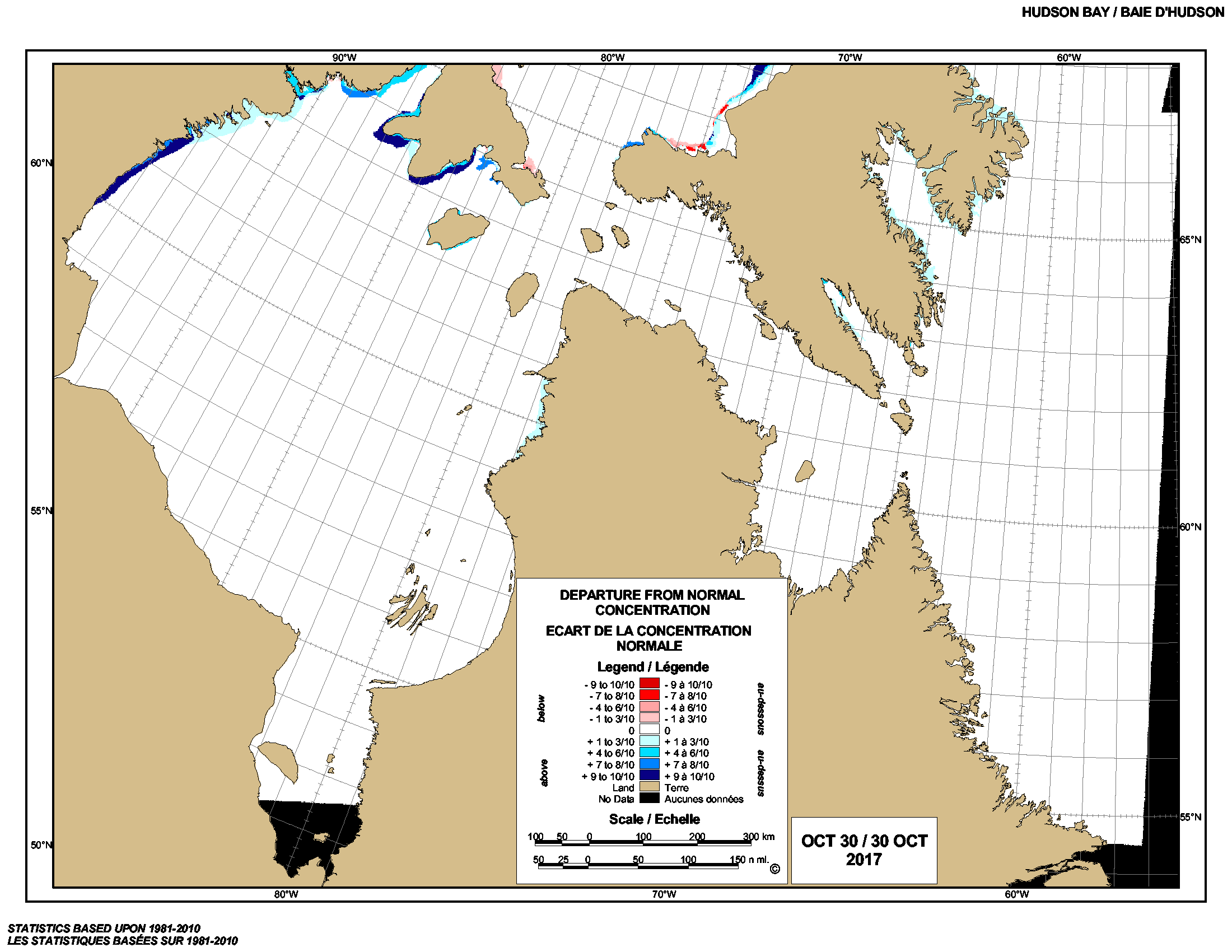
In contrast to 2016, when freeze-up along Western Hudson Bay was about as late as its ever been (early December), ice is already forming along the shore of northern Hudson Bay. There is much more ice than usual for this date, indicated by the dark blue in the latest weekly ice chart below:
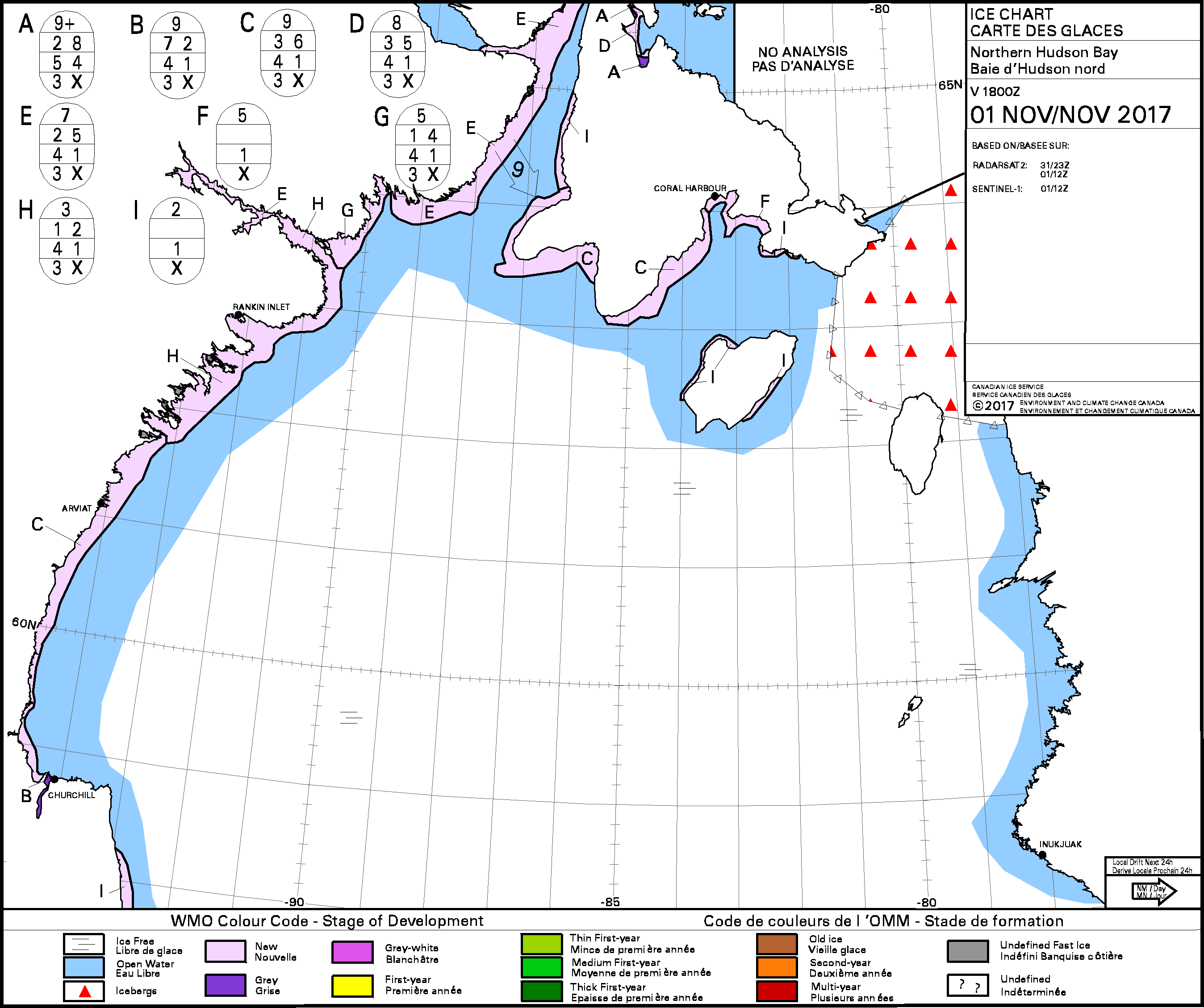
The ice is still thin, as the chart below indicates, but that’s how freeze-up starts. As long as strong winds don’t blow the ice away (as it sometimes does at this stage), the ice gets thicker day by day — and advances further and further off shore. Polar bears get out on the ice as soon as they are physically able, when the ice is about 3-4 inches thick (about 10 cm) or less.
Below is a video of a bear traversing that thin ice yesterday (1 November 2017), near Churchill. Is this a portend of a…
View original post 176 more words
