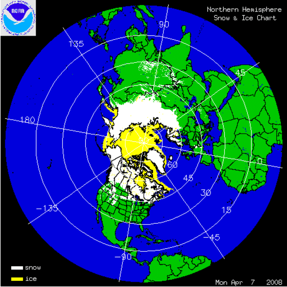
 As many have experienced, Springtime has been slow to arrive in the Northern Hemisphere this year. The data on snow and ice confirm what people are seeing for themselves. The image above shows how Spring snow cover has been increasing lately on day 98 (April 7-8) 2008 to 2018.
At Rutgers snow lab, such images are digitized into statistics suitable for graphical analysis. The graph below shows how March snow cover has varied over the decades of satellite observations
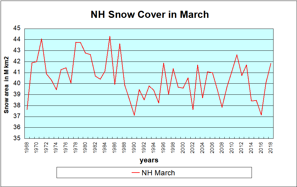
The first two decades averaged ~41.5M km2 snow cover in March. The next two decades averaged about 2M kn2 less, 39.5M. Since 2008, there was a rise to 2011, a drop to 2016, recovering the last two years.
As for ice extent, the 2018 picture in Barents Sea is exceptional, holding onto ~800k km2 of ice extent, 26% above the 11 year average.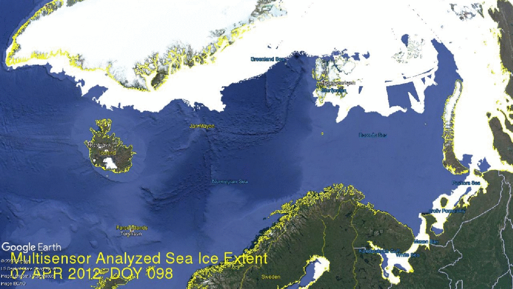
Elsewhere the Arctic ice core is unchanging, the…
View original post 14 more words
