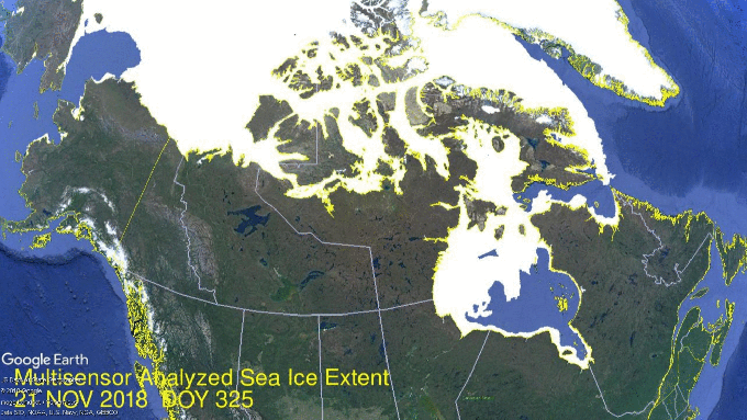
 Seventeen Days in Hudson Bay are shown in the above animation. In the lower center, Hudson Bay pushed its ice extent up to 1.24M km2, 98% of maximum. Just to the northeast, Hudson Strait and Ungava Bay are completely frozen over, with Baffin Bay reaching down. At the top left you can see Chukchi Sea growing ice toward Bering Strait.
The graph below shows recent progress in ice extent recovery.
 From days 330 to 339, 2018 extents were flat and went below average. Now freezing has resumed as shown in the animation above and nearing average again in the graph. At day 342 (Dec. 8) 2018 is 540k km2 greater than 2007 and 400k km2 more than 2016.

The table below shows the distribution of ice in the various Arctic basins.
| Region | 2018342 | Day 342 Average | 2018-Ave. | 2007342 | 2018-2007 |
| (0) Northern_Hemisphere | 11502523 | 11629820 | -127297 | 10963264 | 539259 |
| (1) Beaufort_Sea | 1070498 | 1069593 | 905 | 1062538 | 7960 |
View original post 129 more words
